
Ground & root radar FAQ
Here we answer common questions about ground-penetrating radar and its wide range of applications.
Do you have any questions that aren’t answered here, or would you like a personal consultation to discuss your specific needs?
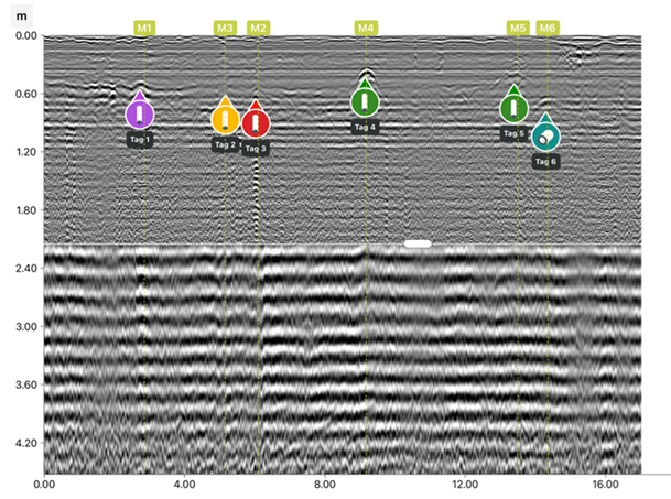
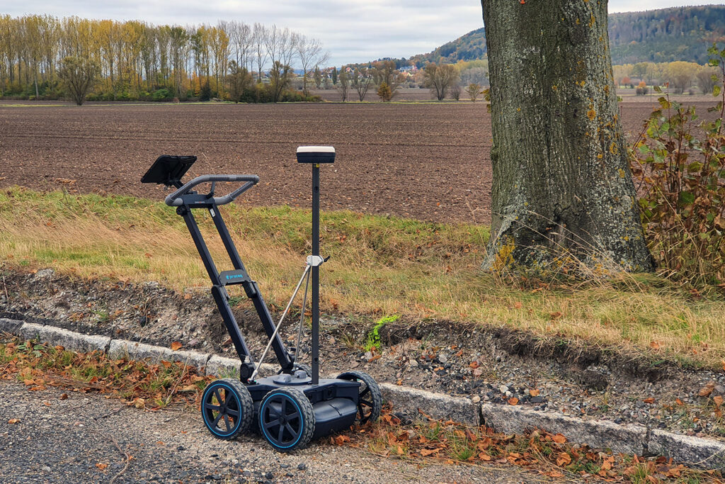
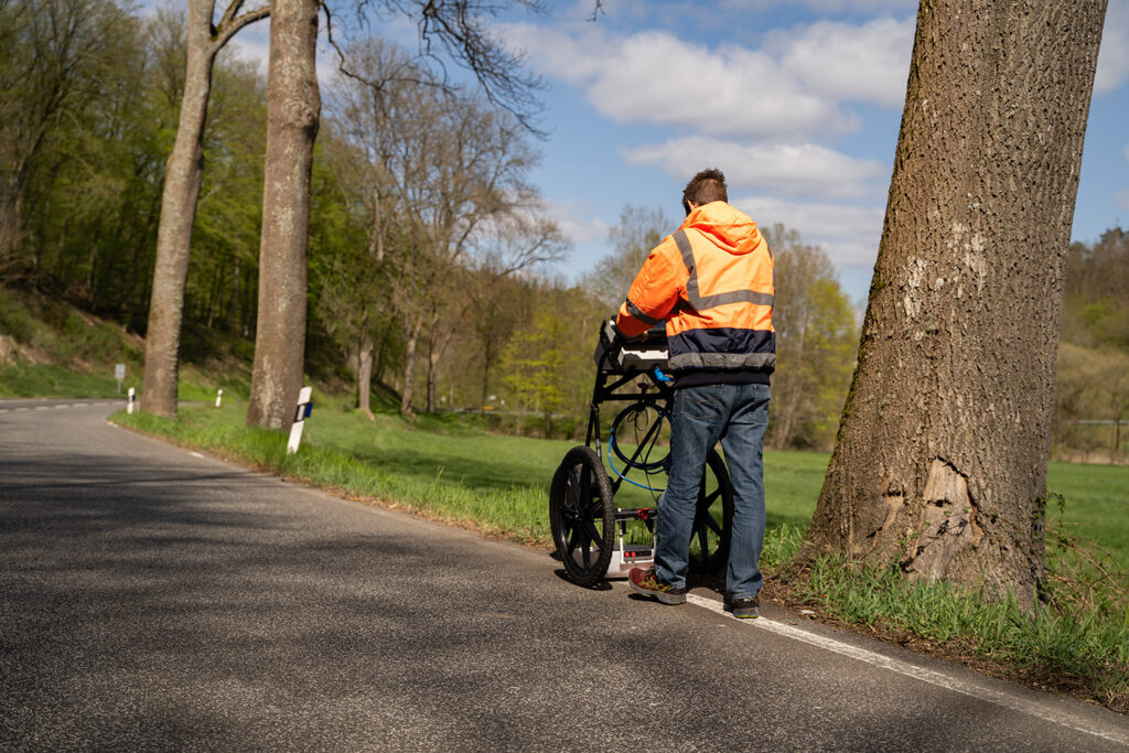
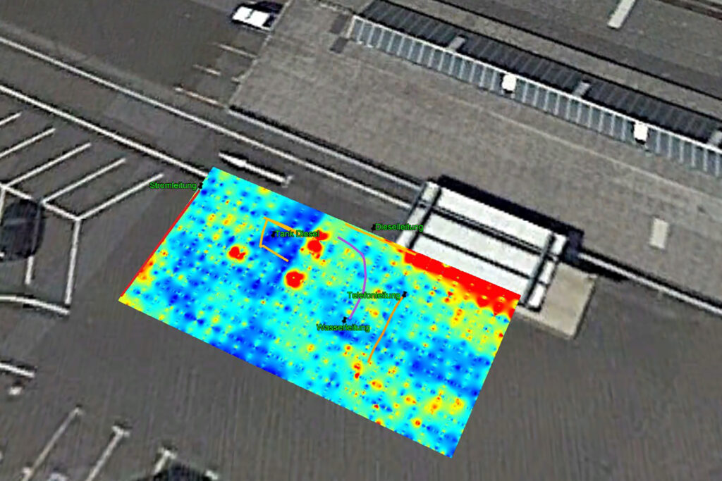
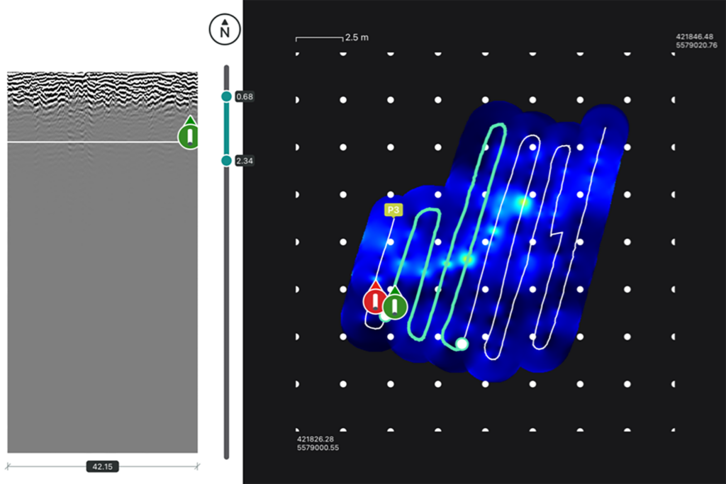
Our ground penetrating radar equipment is used to record and map the subsurface in the highest resolution. With the help of the Proceq GS-8000 and the TreeRadar BS-900, we detect metallic, as well as non-metallic lines and other objects in the underground. The soil is not destroyed during the collection. The measuring procedure is based on the use of a transmitter-receiver antenna. The transmitter antenna sends electromagnetic pulse waves underground. The wave velocities of the soil penetration differ here depending on the subsoil conditions. If the wave hits an object in the ground, the pulse wave is reflected by the object and detected by the receiver antenna. It is shown as a radargram in the form of a hyperbola on the display.
By using a powerful GPS antenna and precise recording of the geo-coordinates with the help of up to 30 satellites, the location can be recorded exactly. This is done via multiband GPS + Glonass + Galileo + Beidou.
The scan data is collected by means of a GPR antenna in the form of electromagnetic pulses. The dielectric value can be used to determine the length, depth, diameter and type of object and to display individual soil layers.
Using software for the ground penetrating radar equipment that has been specially developed for the evaluation of GPR data, specific objects can be quickly identified and clearly marked in the scans. This makes it possible to evaluate the data directly on site.

Due to the multitude of file formats in which the evaluated data can be output, SEGY, KML, DXF, DWG, SHP and HTML, the data can be built up and printed by means of map programs or conversion in CAD to physical or digital plans.
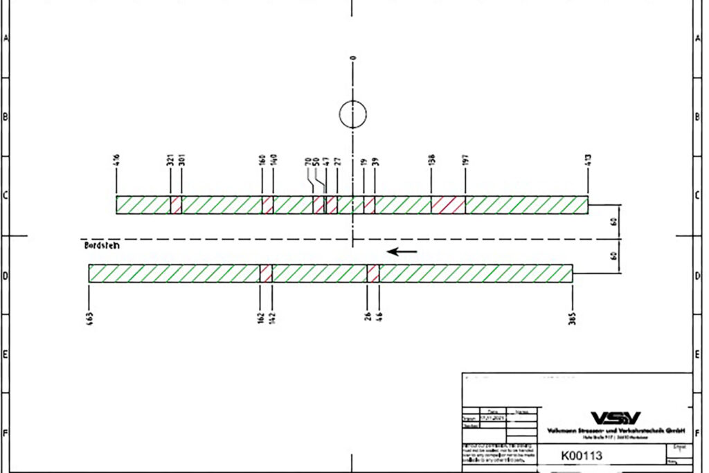
The collected and evaluated data and plans can be made available at the end of the project in pure data form or also in physical form through plans and on data carriers for use on the construction site or for passing on to customers.
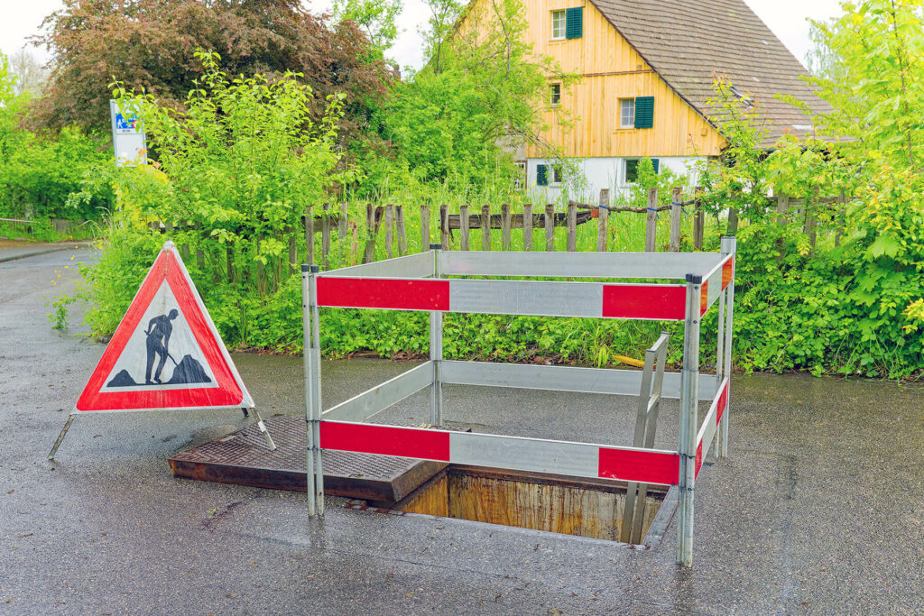
Temporary or long-term construction site protection according to RSA (guidelines for the protection of work sites on roads) is also possible to ensure the protection of workers and also road users during the measures. Please contact us about this.
We offer the following measurement methods: Line Scan, Grid Scan, Free Path, A-Scan, Line Scan and Migrated Line Scan.
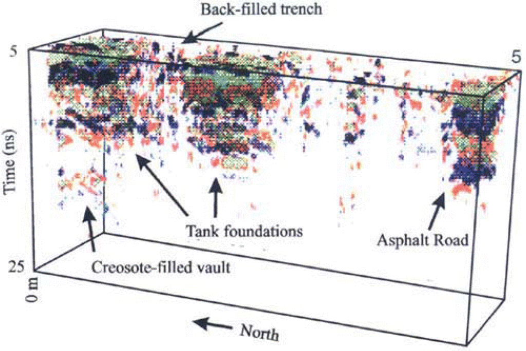
“Electromagnetic (EM) induction and ground penetrating radar (GPR) are geophysical techniques routinely used to investigate the near-surface subsurface for engineering and environmental purposes (Annan and Daniels, 1998; Greenhouse and Slaine, 1983; and Olhoeft, 1986). These two methods have been widely used in recent decades to meet the growing need for a non-invasive and cost-effective method to characterise contaminated sites.
Both techniques have proven useful for locating subsurface features that contain contaminants and for mapping geological features that may influence or trap the flow of contaminants below the surface.
To achieve optimum measurement results, we need a dry surface, the area should be accessible and free of obstacles and, if possible, any existing plans should be included.


Download brochure
Download our ground and root radar brochure in PDF format.

Ask the experts
Talk to us – we will be happy to advise you
Our experts develop customized concepts for your individual situation.

Christopher Ahnert

Torben Kunz
About us
Get to know us and find out more about our service portfolio and what we can do for you.
Volkmann Strassen-
und Verkehrstechnik GmbH
Hohe Strasse 9-17
56410 Montabaur